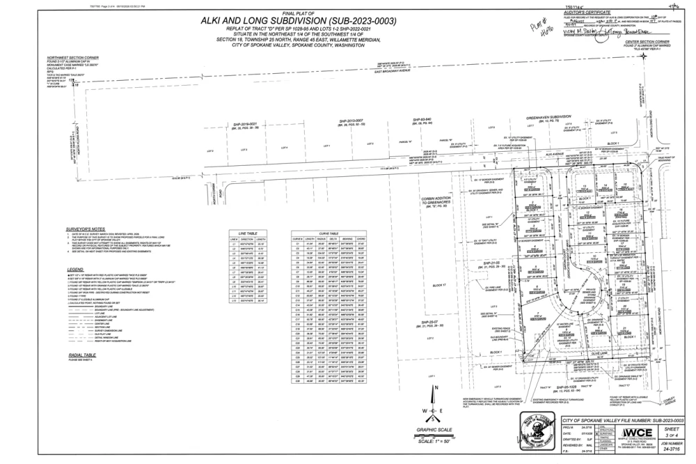

- Owner
- Juniper Ridge Holdings LLC
- Assessed value
- $842,500
- Zoning
- RR-5
- Acreage
- 18.42 ac
- Parcel
- 14-08-22-00-00140
- Flood zone
- Zone X
- Last sale
- Jun 12, 2024 · $790,000
Trusted by single-county abstractors and national underwriters
The title processing platform built for high volume.
Extraction, examination, plant health, and parcel monitoring in one system. County images in. Plant-ready records out, posted under your rules.
1882Handwritten deeds, read back to patent
8Plant health categories graded nightly
NativeDelivery into PropertySync
Plat builderAlki and Long Subdivision · SUB-2023-0003
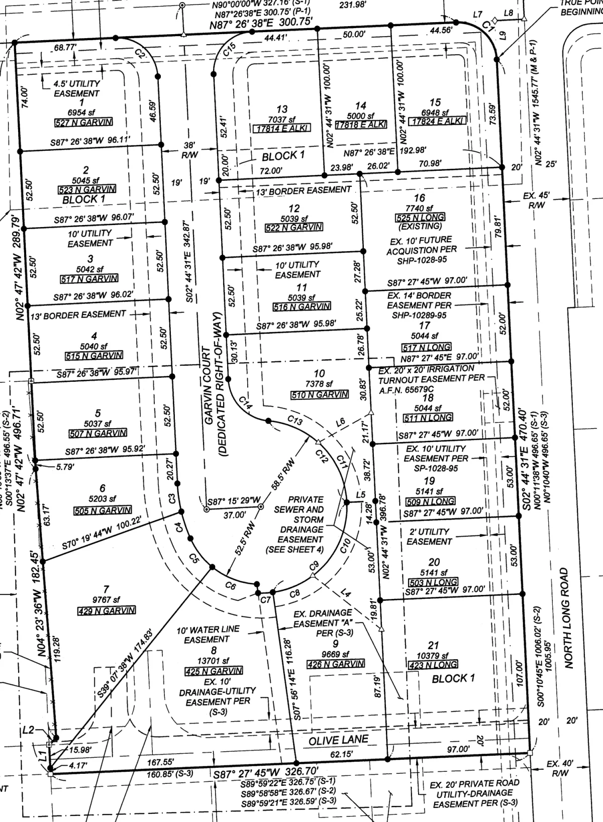
Lots21 of 21 closed
Lot 55,037 sf
Lot 65,203 sf
Lot 79,767 sf
Lot 813,701 sf
Lot 99,669 sf
Validation rulesPublished
Document processingSpokane County · Oct 1 batch · 214 of 1,286
−84%+
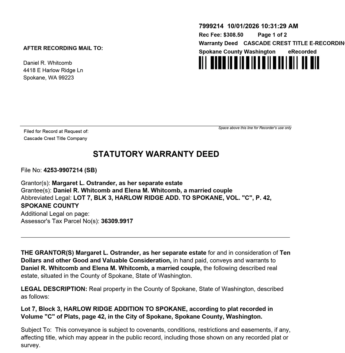
Extracted recordStatutory Warranty Deed
Ready to postInstrument no.799921499.9
RecordedOct 1, 2026 · 10:31 AM99.8
GrantorMargaret L. Ostrander99.4
GranteeDaniel R. Whitcomb
Elena M. Whitcomb99.1
Elena M. Whitcomb99.1
LegalLot 7, Block 3, Harlow Ridge Add.
Vol. C of Plats, p. 4298.7
Vol. C of Plats, p. 4298.7
Consideration$10.00 and OGVC96.2
Plant rules14 of 14 passedPost to plant
Plant HealthSpokane County plant
A−92 / 100
Overall gradeUp 6 pointssince August
- Recording coverageA
- SubdivisionsA−
- Party namesB+
- Document typesA
- Cross-referencesB
- ConsiderationA−
- Legal descriptionsB+
- DatesA
Watching 1,240 parcels
!
Lien recorded on a watched parcel36309.9917 · 4418 E Harlow Ridge LnClaim of lien · Inst. 7999388 · 2 min ago
The platform
Every tool in one system.
One plant, one login, one source of truth. Each tool reads from the same records, so work done in one shows up everywhere.
Document processing
County images in. Plant-ready records out.
Recording packets become plant-ready records for go-forward posting, gap fill, and full plant builds. Handwritten and typed.
See document processing ›Parcel Watch
An alert when a deed, lien, or mortgage records against a parcel.
Explore Parcel Watch ›SubdivisionIQ
Plat and covenant search for your website, served from your plant.
Explore SubdivisionIQ ›FIRPTA
A documented FIRPTA answer on every closing file.
Explore FIRPTA ›Plant Health
A graded diagnostic for PropertySync go-forward customers.
Explore Plant Health ›OFAC screening
A clear or a match on every party, with the list and the date on the file.
Bankruptcy search
Case, chapter, and filing date for a party, looked up with the file.
Spatial data
GIS & property intelligence
Search a parcel by address, owner, parcel number, or coordinates. County mapping sits beside the plant. Metes-and-bounds descriptions parse into a plot, including curves and Texas varas, and every description gets a closure analysis. Ownership, assessed value, zoning, flood zone, and sale history live in one model.
Warranty deed
Beginning at a found iron at the northwest corner of the Juniper Ridge tract; thence S 12°14'00" E, 420.00 feet; thence N 78°40'00" E, 310.50 feet; thence along a curve to the right, radius 180.00 feet, arc 94.20 feet; thence N 11°02'00" W, 188.40 varas; thence S 80°15'00" W, 402.10 feet to the point of beginning.
- Segments
- 6
- Area
- 18.42 ac
- Closure ratio
- 1:48,200
- Curves
- 1 included
- Units
- Feet and Texas varas
- Status
- Closed
Document processing
We index documents for go-forward posting, gap fill and full plant builds.
- Go-forward posting. Each day's recordings, extracted, checked, and posted.
- Gap fill. Missing years and document types, posted under your rules.
- Full plant builds. A full county back-file, processed into a plant.
County image batch · Oct 1 · 48 images
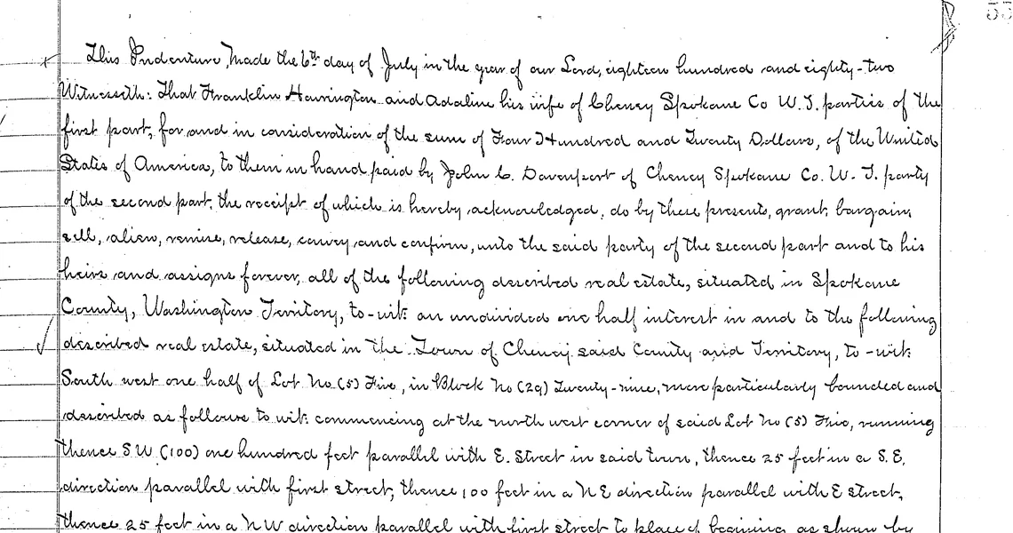
Extracted record
Warranty deed99
Instrument7999214
GrantorM. Whitcomb
GranteeA. Ostrander
LegalLot 7, Harlow Ridge
PropertySync review batch3 documents
| Inst. | Type | Parties | Status |
|---|---|---|---|
| 7999214 | SWD | Whitcomb to Ostrander | Ready |
| 7999215 | DOT | Ostrander to Harlow CU | Ready |
| 7412093 | REL | Prior deed of trust | Hold |
Scale
MillionsMillions of documentsThe volume a working plant runs.
MinutesPosted within minutesGo-forward, from the images to the plant.
10xAn order of magnitude fasterFull plant builds versus traditional keying.
Why TitleTools
- The original engineering team behind PropertySync
- 10+ years in the title industry
- Thousands of documents a day
- US cloud, nothing to install
- Full audit trail
- Pay per use, no minimum
Talk to us.
Tell us about the plant or the firm. A real person replies.